WEATHER DISCUSSION – Thursday May 1, 2025 –
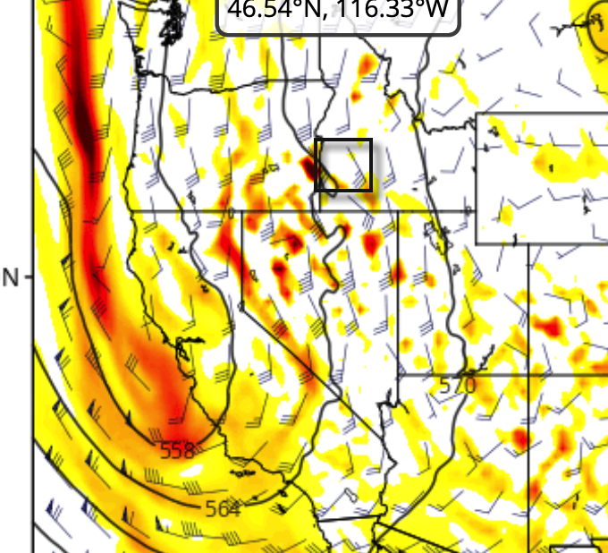
High pressure ridging is mostly expected before the May 3 last day of the ski season at Bogus Basin, where Bogus Basin is planning to be open for one last blast. Strong low pressure is projected to move through TO the south on that day, Saturday May 3rd, focused on southern California, and the expected track to the south leaves Bogus Basin with mostly sunny skies for most of the open hours, and mild temperatures.
The 500mb chart below is for Saturday at 4pm, and shows the bulk of the strong incoming storm moving south and leaving Bogus Basin with now mostly sunny skies for the last day of the season.
HAVE you seen our SNOW DEPTH MAPS?? See below for what they look like. Pretty accurate and detailed, very zoomable. Go to any forecast page and access them, or from the home page.
LONGER RANGE
Overall we are likely going to see more winter-esque (than usual) weather drag on a bit into late spring/ early summer. Snowforecast.com Meteorologist/ Chris Manly (I have been actively forecasting weather and snow for ski resorts since 1998)


