WEATHER DISCUSSION – Friday July 4, 2025 –
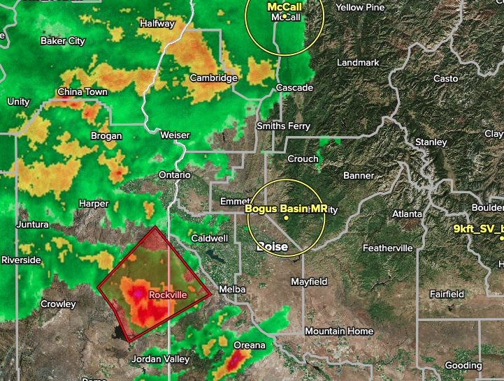
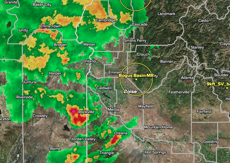
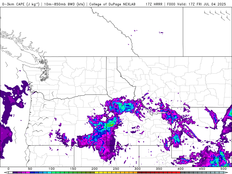
A fairly strong low pressure system is triggering some thunderstorms and showers today, good dousing/ soaking rains for Bogus Basin to kick off July. There is a severe thunderstorm warning for just southwest of Boise (pictured below in the radar image), mainly for small hail and 60mph wind gust potential in any T-storm. I think there will be more of these including for Bogus Basin before the day is done. The “CAPE” animation below covers 11am to 8pm today, July 4, and shows strong CAPE (Convective Available Potential Energy) for the region through this afternoon mainly. We will be firing up the outlooks soon, and are excited for 2025-2026!
HAVE you seen our SNOW DEPTH MAPS?? See below for what they look like. Pretty accurate and detailed, very zoomable. Go to any forecast page and access them, or from the home page.
LONGER RANGE
Overall we are likely going to see more winter-esque (than usual) weather drag on a bit into late spring/ early summer. Snowforecast.com Meteorologist/ Chris Manly (I have been actively forecasting weather and snow for ski resorts since 1998)